Technology has considerably pushed the boundaries of what was once impossible, through the tap of a finger or a click of a button. Yet, amongst all these new found possibilities, some long-established techniques can still hold their ground and provide users much more than a technological gadget ever could.
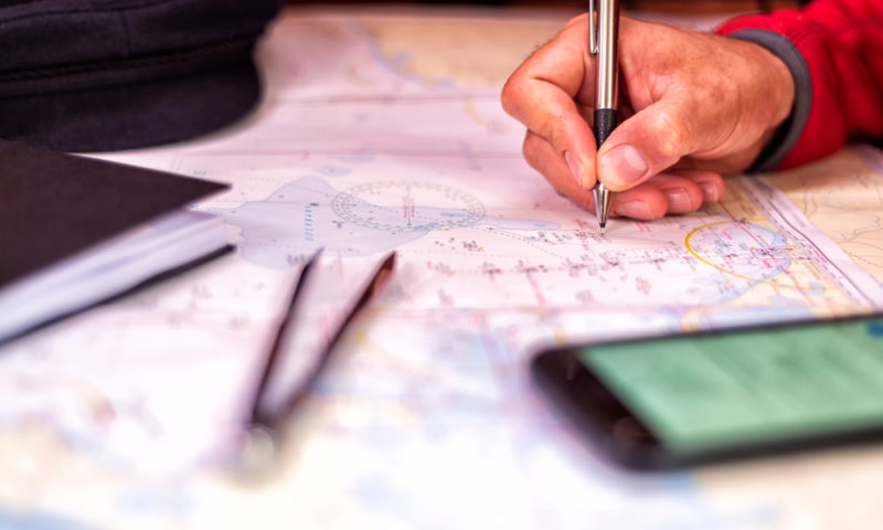
This is the case of navigational charts. For centuries, mariners have relied on these hand-drawn publications to assist them in their sea voyages across the sea. The 21st century has seen an increase in navigational chart usage by professional ship captains and recreational seacraft owners alike.
The question remains… amidst the myriad of electronic navigational charts (ENCs) and tracking devices, why have navigational charts retained their established influence within the sailing world?
what you see is what you get
Numerous incidents have been reported following the misuse of electronic charts, such as not zooming enough to spot a sea hazard or shallow waters, running the risk of grounding. Paper charts allow seafarers to easily spot perils and proactively act upon them, especially if large-scale charts are consulted prior and during the journey.
WATER-RESISTANT PAPER
Getting water onboard a vessel is as common as getting crumbs in a kitchen. Projections are mapped out on water-resistant sheets to avoid any data destruction from exposure to water. This will provide peace of mind for all onboard and secure the re-use of charts for future travels.
UPDATES AVAILABLE
Shorelines and oceans are always changing through the natural processes of storms and earth movements, man-made constructions and implementation of pipelines. These all automatically effect the routes navigational trails. Whilst ENCs can be easily updated, paper charts can be physically amended based on the latest data collected to ensure that seafarers have the correct picture for a safe journey.
RACE REQUIREMENTS
Due to their reliability, certain racing clubs require participants to carry paper nautical publications to cover the race journey and any competitions. Seafarers need to be familiar with mappings and markings of physical charts as well as digital.
NO CHANCE OF FAILING TECHNOLOGY
Whilst it cannot be disputed that ENCs carry the benefits of the latest technology, paper charts do not require satellite data to operate or suffer the aftermath of failing batteries. Electrical failure can easily shut down the whole navigational system; leaving seafarers with increased issues to deal with. Even technology fails sometimes and having a back-up can save you from uncertain journeys.
ACADEMIC REQUIREMENTS
Maritime schools recognise the importance ENCs hold in today’s nautical industry and encourage the use of modern tools. However, the fundamentals of maritime teaching imply that seafarers should understand the fundamentals of navigation for the best and safe use during chart plotting.
Sailing across the seas, whether it’s for business or pleasure, should not be taken lightly. Having a reliable set of nautical charts might make or break your journey. Get in touch with our shipping team to order your updated version now and let your sailing take you to new places.